Record Winter Rainfall Triggers Statewide Flood Watch Across Wheatbelt Communities
Unprecedented winter rainfall has placed Wheatbelt regions on heightened alert as authorities move swiftly to manage rising flood risks.
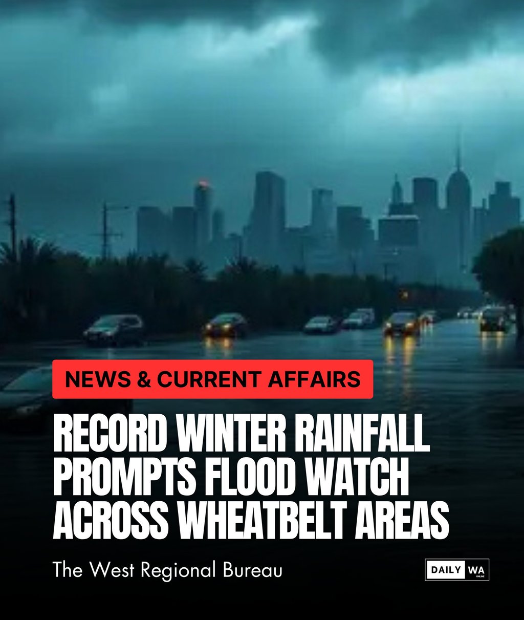
Rain can be both a lifeline and a warning. For much of Western Australia’s Wheatbelt, this winter has delivered rainfall levels that exceed historic averages and in doing so has introduced a new set of challenges for communities that depend on predictable weather patterns. When records begin to fall, the systems designed to protect people, farmland, and regional infrastructure are tested in ways that demand both immediate action and long term foresight. The current flood watch across Wheatbelt regions is not merely a seasonal alert. It is a reflection of changing environmental conditions that require renewed attention and collective resilience.
The Wheatbelt is accustomed to variability, yet the volume and intensity of recent rainfall has surpassed expectations. Meteorological data indicates that several areas have recorded their highest winter totals in decades. Such anomalies prompt more than curiosity. They compel authorities to reassess water flow patterns, drainage capacity, and the speed at which minor weather events can escalate into significant flood threats. When ground saturation reaches critical levels, even moderate rainfall can trigger rapid water movement across farmland and rural roads. This dynamic sets the stage for the type of widespread caution now being exercised.
Emergency agencies have responded quickly by issuing region wide flood watches and mobilising assessment teams to monitor creek levels, soil conditions, and potential problem areas. Their work is essential in a region where agricultural productivity and community stability rely heavily on the ability to manage water effectively. Experience has shown that early warnings and coordinated communication can significantly reduce the impact of floods, particularly for remote areas where access routes may be limited. These alerts are not designed to create alarm but to prime communities for proactive decision making.
To understand the significance, consider the scenario of a Wheatbelt farming district where machinery, livestock, and harvest preparations are already in motion. A sudden rise in water levels can disrupt operations within hours, isolating properties and compromising safety. In previous high rainfall years, farmers reported substantial delays and financial strain as flooded paddocks prevented timely movement of equipment. This year’s rainfall has revived those concerns and reinforced the importance of strategic planning supported by accurate weather modelling and clear communication.
Authorities are also looking closely at road networks, which form the lifeline between rural communities, service hubs, and emergency support. Prolonged waterlogging weakens road structures, increases the risk of washouts, and restricts the transport of essential goods. Even short term closures can carry significant consequences. Studies on regional infrastructure resilience highlight that communities with advanced flood preparedness plans experience faster recovery and reduced economic burden. This underscores why the current flood watch has been positioned as both a cautionary measure and an opportunity to strengthen community readiness.
The agricultural sector is weighing the implications as well. Winter rain is ordinarily welcomed, yet record volumes introduce complications such as soil erosion, crop water stress, and delayed seasonal tasks. While many producers remain optimistic about long term moisture benefits, they also recognise the need to adapt to shifting climate patterns. Conversations across agricultural networks reveal a growing emphasis on risk modelling and adaptive land management. These insights reflect a broader trend where resilience is becoming a central pillar of rural strategy.
The record rainfall also invites a wider discussion about environmental change and the importance of future focused planning. As weather events become more extreme and less predictable, communities must evolve their approach to risk. That evolution requires collaboration across government agencies, local councils, emergency teams, and industry bodies. Each plays a role in building systems that can withstand the pressures of shifting climate conditions. This moment offers a powerful reminder that preparedness is not defined by crisis but by the decisions made beforehand.
For organisations working in strategic planning or operational coordination, the Wheatbelt flood watch serves as a practical illustration of why foresight matters. The capacity to analyse emerging patterns, anticipate vulnerabilities, and allocate resources effectively is essential. At TMFS, these principles shape the work we deliver for clients navigating complex and unpredictable environments. When uncertainty grows, the organisations that succeed are those that strengthen their frameworks before stress arrives.
As Wheatbelt communities monitor weather updates in the days ahead, the flood watch provides not only caution but clarity. It encourages residents, farmers, and regional leaders to stay attentive, to communicate early, and to protect what matters most. It also reinforces the understanding that resilience is built through shared effort and informed choices.
The record winter rainfall will eventually ease, but the lessons it brings will remain. This season has revealed how quickly conditions can change and how essential it is to have strong systems and partnerships in place. As the region responds and adapts, TMFS will continue to support approaches that prioritise safety, foresight, and sustainable resilience across Western Australia.
All rights belong to their respective owners. This article contains references and insights based on publicly available information and sources. We do not claim ownership over any third party content mentioned.
DAILY WA © 2025
Daily WA Online is an independent news and media platform covering Western Australia. Owned by TMFS International Pty Ltd., we publish local stories, business insights, lifestyle features, and community voices for the digital era.