Severe weather update: Dangerous fire weather for Perth and WA
Western Australia is facing another intense summer heatwave, with extreme temperatures, warm nights, elevated fire danger, and the risk of dry thunderstorms creating challenging and potentially dangerous conditions. The piece highlights how early awareness, clear communication, and trusted interpretation of weather data are critical to protecting communities, supporting emergency response, and strengthening preparedness in a climate where extreme heat and fire risk are becoming more frequent and severe.
NEWS & CURRENT AFFAIRS
Heat has a way of revealing truth. It strips away comfort, tests systems, and exposes how prepared a community really is. As Western Australia moves deeper into another intense summer pattern, the convergence of extreme temperatures, volatile winds, and elevated fire danger is not just a forecast. It is a moment that demands attention, understanding, and leadership.
Across Perth and large parts of the state, conditions are aligning in a familiar but increasingly consequential way. Heatwaves are not unusual for WA, yet each event carries unique risks shaped by duration, overnight temperatures, and the behaviour of wind systems. What separates a difficult weekend from a dangerous one is how early the signals are recognised and how clearly the risks are communicated.
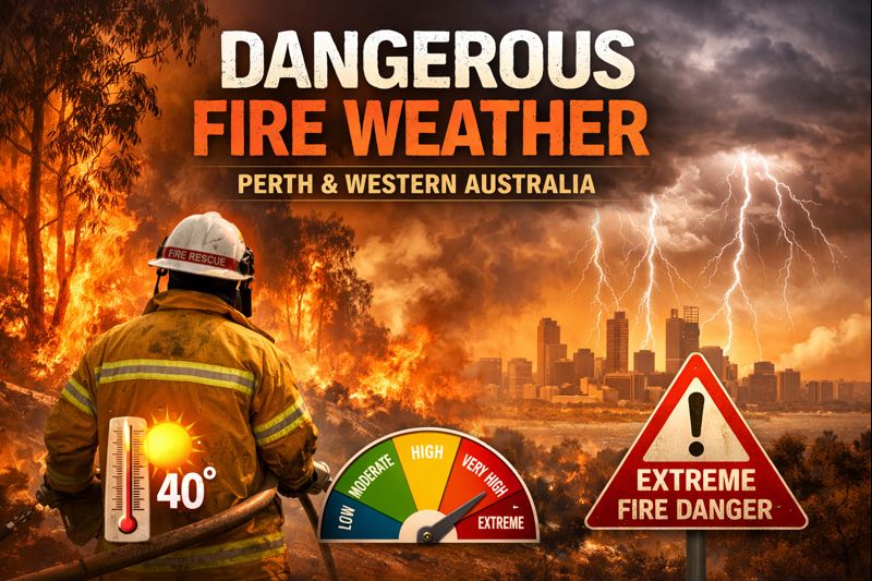
This weekend is defined by a strengthening heat trough drawing hot air from inland and northern regions across the southwest. Daytime temperatures climbing into the high thirties and low forties are only part of the story. Warm nights that struggle to drop below the mid twenties prevent physical recovery and compound heat stress. Research consistently shows that consecutive hot nights significantly increase the risk of heat related illness, particularly among older residents, outdoor workers, and those without adequate cooling.
Fire danger escalates alongside this heat. When high temperatures combine with low humidity and gusty winds, the environment becomes primed for rapid fire spread. Fire danger ratings of high and extreme are not abstract labels. They are evidence based indicators that suppression becomes more difficult, response windows shorten, and small ignitions can quickly evolve into major incidents. Recent fire behaviour across the eastern suburbs of Perth illustrates how fast conditions can deteriorate when weather, terrain, and fuel align.
Thunderstorm activity adds another layer of complexity. In hot and unstable air masses, storms can develop with little rainfall but significant lightning and damaging winds. Dry lightning is one of the most effective natural ignition sources in Australia. It can spark multiple fires across wide areas simultaneously, stretching emergency response capacity. For communities already under heat stress, this combination represents one of the most challenging weather scenarios of the year.
Understanding these dynamics is not about alarm. It is about preparedness. Data from previous severe fire weather events shows that early awareness directly influences outcomes. Households that adjust plans, reduce exposure, and stay informed experience fewer impacts and recover faster. Emergency services rely on public responsiveness to warnings to do their job effectively. Information is not a passive tool. It is an active form of protection.
This is where trusted interpretation becomes essential. Weather data is abundant, but insight is what turns numbers into decisions. TMFS exists to bridge that gap. By analysing patterns, contextualising risks, and communicating clearly, TMFS supports communities in understanding not just what is happening, but why it matters. Authority in this space is built through consistency, accuracy, and respect for the audience’s ability to act when given the right information.
Real world scenarios highlight this value. A family in the Perth hills deciding whether to stay or relocate during extreme fire danger. A business adjusting operating hours to protect staff from heat exposure. A local council coordinating resources ahead of a forecast shift in wind direction. These decisions are shaped by confidence in the information source. When guidance is clear and grounded in evidence, action follows.
There is also a broader context that cannot be ignored. Climate trends indicate that heatwaves are becoming more frequent and more intense across southern Australia. Fire seasons are lengthening. The margin for error is shrinking. In this environment, leadership is not reactive. It is anticipatory. It prepares people before conditions peak and reinforces vigilance even when relief arrives.
Relief, when it comes, is often uneven. Coastal cooling can coincide with rising temperatures along the south coast as wind patterns shift. This uneven distribution of risk reinforces the need for localised understanding rather than blanket assumptions. What feels manageable in one suburb may be dangerous in another just kilometres away.
TMFS approaches severe weather communication with this nuance in mind. The goal is not to overwhelm, but to empower. Clear expectations reduce cognitive load. Repetition reinforces key messages. Consistent framing builds trust. These principles, supported by behavioural science, ensure that critical information is more likely to be noticed, remembered, and acted upon.
As this heatwave unfolds, the most important takeaway is simple but powerful. Preparedness is not a single action. It is a mindset. It is checking updates regularly, adjusting routines, looking out for vulnerable neighbours, and respecting warnings even when skies appear calm. It is recognising that extreme weather is no longer an exception, but a feature of our environment.
TMFS remains committed to providing timely, credible, and actionable insights throughout the season. By staying informed and engaged, communities strengthen their resilience and reduce the human and environmental cost of extreme events. Awareness today shapes outcomes tomorrow.
All rights belong to their respective owners. This article contains references and insights based on publicly available information and sources. We do not claim ownership over any third-party content mentioned.
DAILY WA © 2025
Daily WA Online is an independent news and media platform covering Western Australia. Owned by TMFS International Pty Ltd., we publish local stories, business insights, lifestyle features, and community voices for the digital era.